
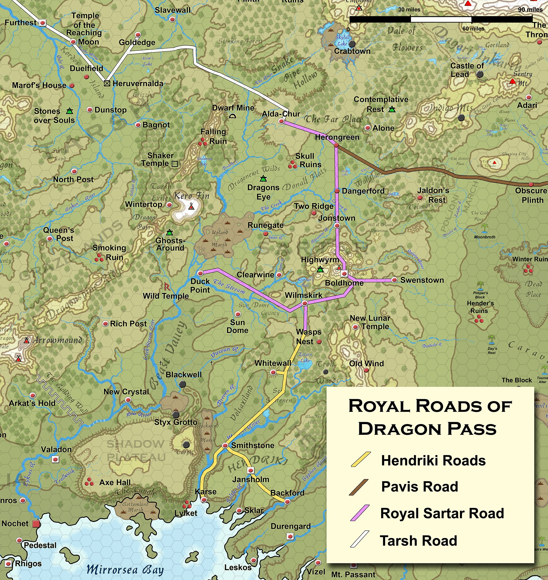
Here’s a nice little map showing the royal road network of Dragon Pass.


These are Greg’s maps and Greg’s distances (really, I have all of Greg’s master maps). It is entirely possible that when Greg looked quickly at a map he gave an overly large distance in an email response. I know I have done that at on more than one occasion!
I count 21 hexes from the southern border of Sartar to Snakepipe Hollow (I count hexes – that’s why I prefer hexes). On the original White Bear & Red Moon map, I count 21 hexes (same 5 mile per hex scale) between the same points.
That’s the scale of Sartar – about 105 miles from north to south, and about the same from east to west. That’s about 70% the size of modern Switzerland, and larger than the modern province of Lombardy (which managed to play a pretty big role in history). It is almost half-again as big as the ancient kingdom of Ulster which makes it as big a kingdom as any the High Kings of Ireland every directly ruled.
Those seriously are the distances that have always been on Greg’s master maps. Just to give an idea of their age, the overall shape and size of Fronela was established in the late 60s, Dragon Pass was set in 1975. Greg’s master map of Dragon Pass (which used to hang up at the Chaosium office and is now here in Fortress Berlin) dates to the late 70s (with many revisions hand-drawn by Greg over the following decades). The master map of Central Genertela and the West dates to the early 80s, as do Greg’s detailed maps of the West. All of these maps are remarkable consistent on internal scale once you crack the code.
What WAS inconsistent was the maps done by other artists. The Lunar Empire map that Issaries did was wildly off on scale, the various maps in the Orange box were also weirdly off from the master maps (they actually worked off a far less detailed map rather than work off the detailed master maps). But these dimensions really are what Greg has had up on his wall for decades.
In the period 1614-1620 would the Lunars have added a roadway to their new temple to improve transport? Unlikely to be anything more than a dirt wagon road.
Well it is the scale we’ve always had (seriously, these maps have been around a LONG time). At 3,125 miles, the northern continent of Genertela is slightly wider than the continental United States, which given that much of the mythic geography of Genertela is taken from the United States (Rockies, Mount Rainier, Mississippi River, Devil’s Tower, the San Francisco Bay area, the Great Basin, etc.) seems entire appropriate.
Originally posted on G+. Tapatalk Archive.